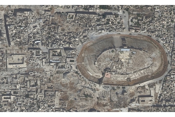
Archaeologists are now using satellite imagery to track sites in war-torn Middle East
Many archaeologists spend their entire careers studying one historical site, getting to know it like they know their own house, says Jesse Casana, associate professor of anthropology at Dartmouth College in Hanover, N.H. That was the case for him and his colleagues working in the Middle East before the war affecting Iraq and Syria made boots-on-the-ground excavation too dangerous an approach.
“They were just suddenly forced to leave, never could go back,” Casana says. “I left a giant building full of my stuff and artifacts and equipment and a suitcase full of clothes. We just never went back.”
Thousands of miles and oceans away, archaeologists like Casana were suddenly unable to keep track of their sites and others in the wider war-torn area. But with the help of a collaborative agreement between the U.S. Department of State and the American Schools of Oriental Research (ASOR), launched in 2014, cultural heritage documentation is now possible without an archaeologist ever having to step foot on a site. Satellite imagery is being utilized to document archaeological sites, historical buildings, museums, mosques and other religious sites that have been damaged by war activity.